A record nine Earth observation satellites were sent into space from Würzburg in July 2026. They are already delivering a wealth of data that exceeds expectations, demonstrating the potential of satellite formations for practical applications ranging from agriculture and disaster management to climate research.
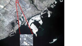
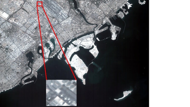
High-resolution image of Dubai captured by the CuBy satellites. Aircraft taking off and waiting at the airport are clearly visible, as is shipping traffic in the harbour.
(Source: CuBy, S4 – Smart Small Satellite Systems GmbH, Würzburg)
In July 2026, a record number of nine Earth observation satellites were sent into space from Würzburg (Germany). They have already delivered a much greater volume of data than expected.
For the first time, so many satellites manufactured in Europe were launched for two formations. The common goal of all nine satellites is to make innovative Earth observation methods available for practical applications. The challenges successfully overcome in manufacturing, operations and data acquisition provide an excellent foundation for future multi-satellite missions.
The five satellites of the CuBy mission, manufactured by S4 GmbH and each about the size of a television, will provide timely, large-area information relevant to cartography, agriculture and forestry, as well as nature conservation and disaster management in parts of Bavaria (Germany). Bavaria's Minister of Finance and Home Affairs, Albert Füracker, emphasises: “Our five CuBy satellites—true high-tech ambassadors from Bavaria—have delivered their first high-resolution images of the Earth's surface from space. The first CuBy images show the Earth's surface in distant countries, and we are eagerly looking forward to receiving the first images of Bavaria in the coming weeks. We wish the mission continued success!”
Images of the cloud-free area around Dubai already demonstrate the capabilities of the satellites' multispectral cameras. The Bavarian State Office for Digitisation, Broadband and Surveying, the Technical University of Munich and the Centre for Telematics (ZfT) will significantly increase the information gained in the future by further processing the raw camera data.
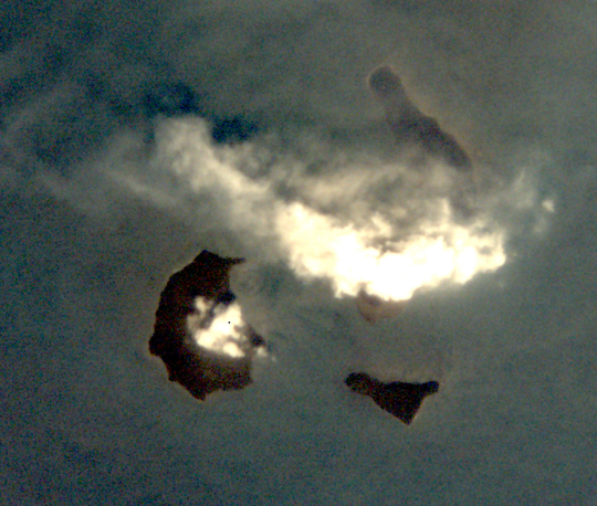
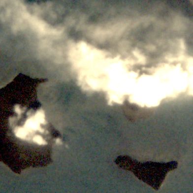
The TOM satellites were flying over the volcanic island of Anak Krakatau during the eruption. From an optimal position, they observed the rising volcanic ash cloud, which was propelled to an altitude of 15 km (approximately 9.3 miles).
(Source: TOM, Center for Telematics Würzburg)
During an overflight by the three TOM satellites, the Anak Krakatau volcano in Indonesia erupted at an ideal moment. The rise of the ash cloud to an altitude of 15 km (approximately 9.3 miles) was directly observed. Air traffic was suspended, leaving more than 340,000 passengers stranded at airports. This demonstrated the ability of very small satellites to provide important warning information about natural disasters in a timely manner.
The three TOM satellites, each about the size of a shoebox, were manufactured in Würzburg (Germany) by ZfT and S4 – Smart Small Satelliten Systems GmbH. Simultaneous images taken from different viewing angles make it possible to generate three-dimensional images. As part of the Regional Leader Summit (RLS) cooperation, current data is transmitted to ground stations in Bavaria's partner regions across five continents, enabling timely responses.
Clouds are among the greatest sources of uncertainty in climate predictions. To gain a better understanding of their properties, three scientists—Yoav Schechner (computed tomography; Technion Haifa), Ilan Koren (climate forecasting; Weizmann Institute, Rehovot) and Klaus Schilling (small-satellite formations; Centre for Telematics, Würzburg)—were awarded an ERC Synergy Grant, one of Europe's top research awards.
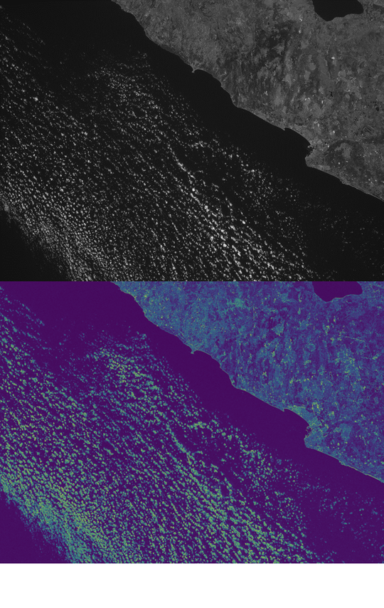
Clouds off the coast of Israel near Haifa. The upper image shows light intensity, while the lower image is a false-colour representation of the polarised light component. The brighter the pixel, the higher the degree of light polarisation. This makes it possible to determine the composition of the clouds accurately.
(Source: CloudCT Precursor, Vadim Holodovski; Technion / Center for Telematics, Würzburg)
The CloudCT Precursor demonstration satellite is being used to prepare and optimise a formation of ten additional CloudCT satellites. From 2027, these satellites are expected to investigate the interiors of clouds using computed tomography methods, with the aim of enabling more accurate climate forecasts.
“The data now obtained using polarised light give rise to high scientific expectations, and we look forward to using these new measurement principles to contribute to better climate forecasts,” explains Professor Klaus Schilling, Chairman of the ZfT.
All nine satellites use advanced control technologies that build on the experience gained during the ZfT's four-satellite NetSat mission, conducted in 2020. This is laying the groundwork for the efficient operation of future global satellite networks.
“The satellites coordinate with one another to perform their tasks together as effectively as possible. This opens up an enormous range of potential applications!” explains Oliver Ruf, S4 CTO.
ZfT CEO Daniel Eck adds: “Manufacturing and testing nine satellites in parallel using sophisticated production technologies requires small-batch manufacturing capabilities. These are being researched at the ZfT's ‘Small Satellite Research Factory’, which makes them available to industry.”
Date: 08.12.2025
Naturally, we always handle your personal data responsibly. Any personal data we receive from you is processed in accordance with applicable data protection legislation. For detailed information please see our privacy policy.
Consent to the use of data for promotional purposes
I hereby consent to Vogel Communications Group GmbH & Co. KG, Max-Planck-Str. 7-9, 97082 Würzburg including any affiliated companies according to §§ 15 et seq. AktG (hereafter: Vogel Communications Group) using my e-mail address to send editorial newsletters. A list of all affiliated companies can be found here
Newsletter content may include all products and services of any companies mentioned above, including for example specialist journals and books, events and fairs as well as event-related products and services, print and digital media offers and services such as additional (editorial) newsletters, raffles, lead campaigns, market research both online and offline, specialist webportals and e-learning offers. In case my personal telephone number has also been collected, it may be used for offers of aforementioned products, for services of the companies mentioned above, and market research purposes.
Additionally, my consent also includes the processing of my email address and telephone number for data matching for marketing purposes with select advertising partners such as LinkedIn, Google, and Meta. For this, Vogel Communications Group may transmit said data in hashed form to the advertising partners who then use said data to determine whether I am also a member of the mentioned advertising partner portals. Vogel Communications Group uses this feature for the purposes of re-targeting (up-selling, cross-selling, and customer loyalty), generating so-called look-alike audiences for acquisition of new customers, and as basis for exclusion for on-going advertising campaigns. Further information can be found in section “data matching for marketing purposes”.
In case I access protected data on Internet portals of Vogel Communications Group including any affiliated companies according to §§ 15 et seq. AktG, I need to provide further data in order to register for the access to such content. In return for this free access to editorial content, my data may be used in accordance with this consent for the purposes stated here. This does not apply to data matching for marketing purposes.
Right of revocation
I understand that I can revoke my consent at will. My revocation does not change the lawfulness of data processing that was conducted based on my consent leading up to my revocation. One option to declare my revocation is to use the contact form found at https://contact.vogel.de. In case I no longer wish to receive certain newsletters, I have subscribed to, I can also click on the unsubscribe link included at the end of a newsletter. Further information regarding my right of revocation and the implementation of it as well as the consequences of my revocation can be found in the data protection declaration, section editorial newsletter.